The salt springs are located in the densely forested gyaguaguayare area of SE Trinidad, to the south of Saunders Road

The topographic map shows the location of the spring on the southern side of a n-s oriented hill. There are also number of rounded hills nearby. The dashed red line represents an abandoned road.

The spring is located on outcrops of Trinity hill sandstone and in proximity to the salt springs fault. To north are outcrops of Upper & lower cruse, Karamat, Cipero and lizard springs. The last three are carbonate marls and are the source of the dissolved carbonates that are later reprecipitated as tufa. Within the Cipero are Herrera sands, potential oil reservoirs.

This geological spot map identifies three seeps and an area of “mudflow”, however No evidence of mudflows was seen during a field visit, Tufa dominates the area. Nearby conical hills represent tufa deposits related to extinct springs.
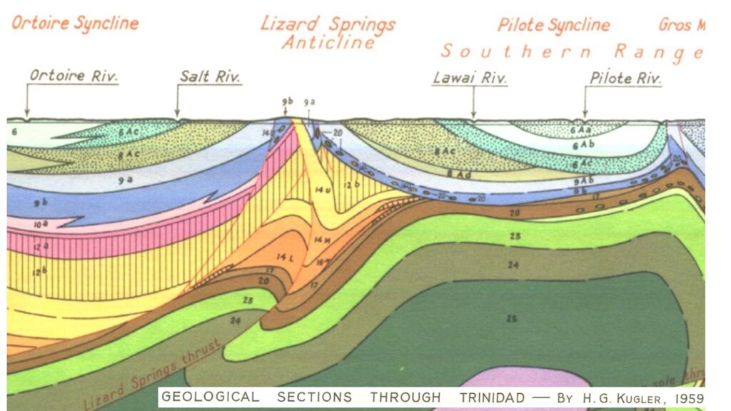
This structural cross section illustrates the structural complexity of the area, with significant thicknesses of carbonate rich rocks and potentially breached Herrera reservoirs.

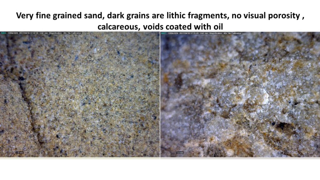
At the site of the seep water is seen actively seeping from the ground and there is a film of heavy oil either in the water or coating the ground. The water when tasted is very salty.

Vegetation grows very close to the seep and seems to be salt tolerant.