Curtis Archie

Geology of Trinidad and Tobago

Skip to content
  • Home
  • Los Iros Slope Failure 21 August 2018
  • Mud Volcanoes
    • Anglais Point
    • Cascadoux
    • Cedros
    • Chatam Mud Volcano
    • Devil’s Woodyard
      • Devil’s Woodyard 30th October 2010
      • Devil’s Woodyard – 22nd May 2022
      • Devil’s Woodyard 1 July 2020
      • Devil’s Woodyard 10th August 2019
      • Devil’s Woodyard 11th February 2001
      • Devil’s Woodyard 13th February 2018
      • Devil’s Woodyard 14th June 2018
      • Devil’s Woodyard 15th March 2003
      • Devil’s Woodyard 17th February 2018
      • Devil’s Woodyard 1st August 2018
      • Devil’s Woodyard 1st September 2018
      • Devil’s Woodyard 24th August 2019
      • Devil’s Woodyard 24th September 2016
      • Devil’s woodyard 28th December 2008
      • Devil’s Woodyard 2nd December 2007
      • Devil’s Woodyard 2nd January 2012
      • Devil’s Woodyard 7th October 2017
      • Devil’s Woodyard 9th February 2021
      • Historical Eruptions and their Frequency
    • Digity Mud Volcano
    • Erin Bouffe
      • Erin Bouffe 10th March 2021
      • Erin Bouffe 12 October 2018
      • Erin Bouffe 1st April 2011
      • Erin Bouffe 20 March 2021
      • Erin Bouffe 22nd January 2020
      • Erin Bouffe 26 August 2019
      • Erin Bouffe 26 March 2010
      • Erin Bouffe 27th March 2015
      • Erin Bouffe 29 May 2020
      • Erin Bouffe 30th January 2020
      • Erin Bouffe 5th October 2018
      • Erin Group of Mud Volcanoes 29 May 2020
    • Impact of Eruptions
    • Karamat Mud Volcano
    • L’Eau Michele
    • L’Envieusse Mud Volcano
    • Lagon Bouffe
    • Marac Mud Volcano
    • Moruga Bouffe
    • Mudflow deposits at Erin Point
    • OFFSHORE MUD VOLCANOES
    • Offshore Point Radix
    • Origin Of Mud Volcanoes
    • Palo Seco Mud Volcano
    • Piparo Mud Volcano
      • 31 August 2018
      • Piparo Mud Volcano – 28th September 2019
      • Piparo Mud Volcano 10th September 2019
      • Piparo mud volcano 11th February 2013
      • Piparo mud volcano 11th November 20111
      • Piparo mud volcano 12th June2012
      • Piparo Mud Volcano 13th November 2019
      • Piparo mud volcano 15 January 2012
      • Piparo Mud Volcano 15 May 2020
      • Piparo Mud Volcano 16 June 2018
      • Piparo Mud Volcano 17 February 2018
      • Piparo mud volcano 19th November 2012
      • Piparo mud volcano 19th October 2019
      • Piparo mud volcano 20th February 2012
      • Piparo mud volcano 23rd September 2019
      • Piparo mud volcano 24 March 2013
      • Piparo mud volcano 25th March 2012
      • Piparo Mud Volcano 26th October 2019
      • Piparo Mud Volcano 29th December 2020
      • Piparo Mud Volcano 3 November 2019
      • Piparo mud volcano 4th December 2011
      • Piparo mud volcano 4th January 2012
      • Piparo mud volcano 5th May 2012
      • Piparo Mud Volcano 7th October 2019
      • Piparo Mud Volcano 8th September 2020
      • WHEN WILL THE PIPARO MUD VOLCANO ERUPT?
    • Quinam Road
    • Rock Dome
    • Tabaquite Mud Volcano
    • Taparo Point – Mudflow deposits
    • TYPES OF MUD VOLCANOES
  • Oil Seeps
  • Posts
  • Publications, Presentations & Field Guides
    • A PICTORAL SURVEY OF MUD VOLCANOES IN TRINIDAD
    • Mud volcano activity in Trinidad – 1995 – 2012
    • Royalty Lease Evaluation Distillation Data an Underutilised tool to aid Geochemical Analysis, an example from Petrotrin’s Soldado Fields
    • Structural evolution and its influence on the deposition of sediments, type of organic matter and hydrocarbons generated in the North Marine Area, Gulf of Paria, Trinidad, West Indies
    • The Identification Of The Depositional Environments Of The Cruse, Forest And Morne l’Enfer Formations In The Southern Half Of The Gulf Of Paria, Trinidad, West Indies
    • THE SUM SUM MEMBER OF THE TALPARO FORMATION , A REGIONAL PERSPECTIVE FROM OUTCROPS
  • The Rocks and Formations of Trinidad
    • Andre Point – Toco
    • BRASSO FORMATION
    • Chancellor Beds – Lady Young Road
    • Charuma Silt – Cunapo Southern Road
    • Chaudiere Formation – Cunapo Southern Road
    • CHAUDIERE FORMATION – San Fernando
    • CIPERO FORMATION
      • Cipero Formation – King St, Princes Town
      • Cipero Formation – Hermitage – Mood Ridge Drive
      • Cipero Formation – Herrera Rock Road
      • Cipero Formation – M2 Ring Road
      • Cipero Formation – Usine St. Madeline
    • Cone in Cone structures in the Cruse Formation of Trinidad
    • Cruse Formation
      • 3.5 km mark Morne Diablo Quarry Road
      • Cruse Formation Guayabel Point
      • Cruse Formation – Majagual Point
      • Cruse Formation – Bunsee Trace
      • Cruse Formation – Chagonaray Point
      • Cruse Formation – East Palo Seco Bay – Anglais point
      • Cruse Formation – Eastern side of Quinam Bay
      • Cruse Formation – Galpha Point
      • Cruse Formation – Palmiste Point
      • Cruse Formation – Palo Seco Bay
      • Cruse Formation – Papelon Point
      • Cruse Formation – Quinam Bay
      • Cruse Formation – Roja Point
      • Cruse Formation – Roqueta Point
      • Cruse Formation – Western side of Quinam Bay
      • Morne Diablo Bay to Siparia Point
      • Reservoir Distribution and Production in Mobile Shale Basins-Examples from the Cruse Formation of Southern Trinidad
      • South Quarry
    • CUCHE FORMATION
    • Cunapo Conglomerate
    • East side of the Saddle, Maraval
    • Erin Formation
      • Chatham – White Cliff
      • Erin Formation – Fr 1621 wellsite
      • Erin Formation – FR 1623 wellsite
      • Erin Formation – Murray Trace, Siparia
      • Erin Formation – Puerto Grande
      • Erin Formation – Punta del Morro
      • Erin Formation at Point Coco
      • Erin Formation at Point Rouge
      • Erin Formation between Granville Beach and Cedros Point
      • Forest Reserve FR-1645 Wellsite
    • Folds on Monos
    • Forest Formation
      • Digity Trace, Debe.
      • Forest Formation – Robinson Trace, Woodland
      • Grant Trace area along the Point Fortin Highway
      • Panoo Trace, Debe
    • Grand Rivere Formation – Balandra Bay
    • Grand Rivere Formation – Chacachacare
    • Grand Rivere Formation- GUYAMARA BAY
    • Gros Morne Formation
      • Gran Calle Point
      • Gros Morne – west of Curao Point
      • Gros Morne Formation – Western side of Guayaguayare Bay
      • La Lune
    • Guayamara Formation – Tompire Bay
    • Lady Chancellor Road
    • Lignites and Origin of Porcellanites
    • Lizard Springs Formation
    • Lower Cretaceous Limestones
    • MANZANILLA Formation
      • Brasso – Caparo Road
      • Brasso Gorge – Telemaque and Monsterrat members
      • Corosal Road – Monsterrat Glauconitic Sandstome
      • Cunapo Southern Road
      • Forres Park Dump
      • Gran Couva Road
      • Maculay
      • North Manzanilla Bay
      • Point Paloma
      • Spring Village – Telemaque Member
      • THE TELEMAQUE MEMBER OF THE MANZANILLA FORMATION – Forres park
    • Marac Quarry
    • Maraval Formation – Maracas Bay
    • Marianne River
    • Mayaro Formation
      • Mayaro Formation – Western side of Guayaguayare Bay
      • THE MAYARO FORMATION AT EAST GUAYAGUAYARE BAY
    • Morne L’Enfer Formation
      • 6c L’MLE PL-344 wellsite
      • A DESCRIPTION OF THE OUTCROPS AT PL 343 WELLSITE ( LOT 7 SILT )
      • ER-89 Wellsite – Upper Morne L’Enfer
      • FR-701 well location
      • GU1086 LOCATION – UPPER MORNE L’ENFER FORMATION
      • LML’E – PL-341 location
      • Parrylands D-84 well location
      • Perseverance (Cedros) 623629 1115003
      • Sobo Road, La Brea – LML’E
      • St Marie Point, Cedros
      • Stollemeyer’s Quarry (east side of Point Fortin road)
      • THE UML’E AT PENAL ROCK ROAD
      • The Upper Morne L’Enfer at Murray Trace
      • UML’E – Rochard Road
      • UML’E – Vance River
    • Naparima Hill
    • NAVET Formation
    • Oil Seeps In San Fernando
    • Pitch Lake
    • Point-a-Pierre Formation
    • Rio Seco Formation – Rampanalgas
    • Rio Seco Formation – Saline Bay
    • Rio Seco Waterfall
    • Sans Souci Volcanics
    • SPRINGVALE FORMATION
      • Fossils of the Savenatta Glauconotic Sandstone
      • Springvale Fm at Forres park
    • TALPARO FORMATION
      • Caparo Clays at Plaisance Industrial Estate
      • Chickland Caparo Road
      • Jusamco Quarry, Soledad Road- Sum Sum Sand member
      • MT. PLEASANT ROAD – Durham Sand member
      • Outcrop at 669518 1144029 in St Margarets
      • Ravine Sable Quarry
      • Sandy View
      • Sum Sum Sand Member along Arena Road
      • TEMPLE STREET – Sum Sum Sand member
      • Windsor Park
    • TAMANA LIMESTONES
      • Batachasingh Quarry
      • Brigand Hill
      • East Quarry, Gasparillo
      • NGC Line – Gasparillo
      • Singh Estate – Corosal Road
      • Tamana Fossils
      • TCL Quarry ,Mayo
      • West Quarry, San Fabien Road, Gasparillo
    • The Galera Formation at Chupara Bay
    • The Grand Rivere Formation at the 34.5 km mark
    • The Los Bajos Fault
    • The Maracas Formation at Las Cuevas Bay
    • Tobago
      • Englishman’s Bay – Parlatuvier Schist
      • King Peter’s Bay
    • Toco Formation – Forest Point
    • Toco Formation – Galera Point
    • Toco Formation – Petite L’Anse
    • Turure Falls
  • Landscapes around the island
  • Salt Spring at Guayaguayare

Cruse Formation – Galpha Point

Leave a reply
This entry was posted in Uncategorized on September 21, 2022 by carchie.

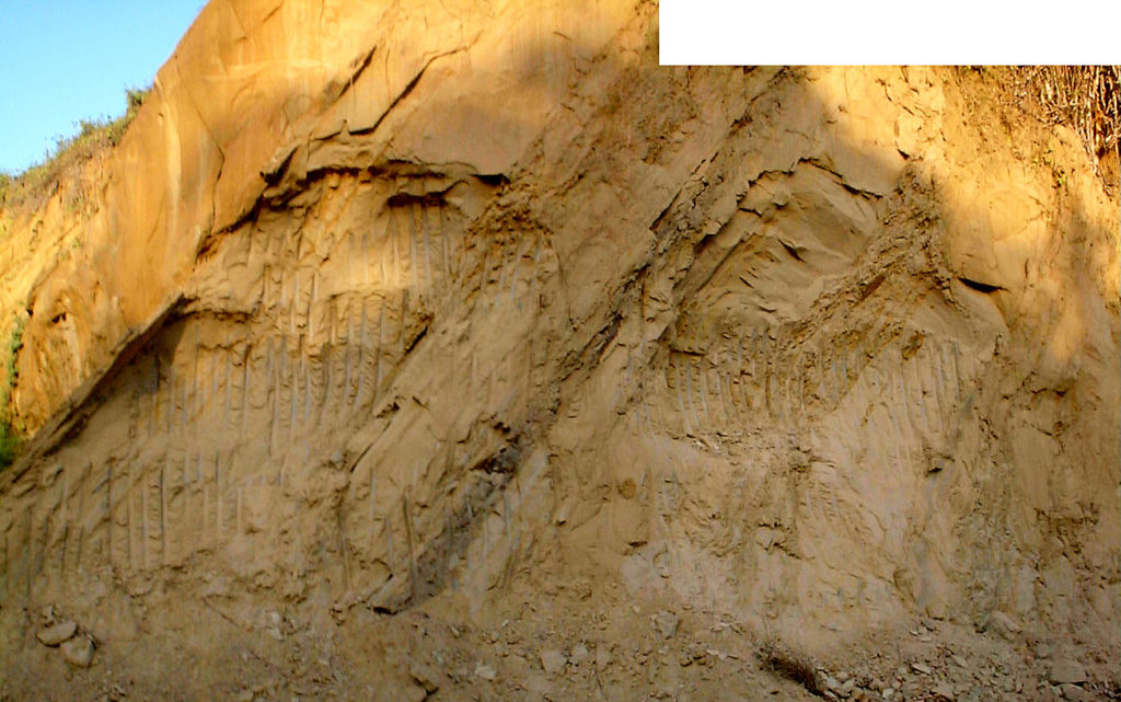
Morne Diablo Quarry Road

Leave a reply

Dip at the top of the section is 600, strike 600, direction of dip 3300

This entry was posted in Uncategorized on April 20, 2019 by carchie.

Hello world!

5 Replies

Welcome to  my website, I am sharing some of my photos, videos and thoughts on the geology and scenery of Trinidad and Tobago. Let me know what you think.

This entry was posted in Uncategorized on April 1, 2018 by carchie.
Proudly powered by WordPress